
Timeline
Nov. 1, 2026, midnight UTC
March 31, 2027, midnight UTC
Submission Rules
The submission for this challenge consists of a single textfile in JSON format. Your submission must include exactly one entry for every panorama in the test region of the data. An entry consists of the panorama identifier followed by its localization on the basemap, given as (x, y) coordinates in meters.
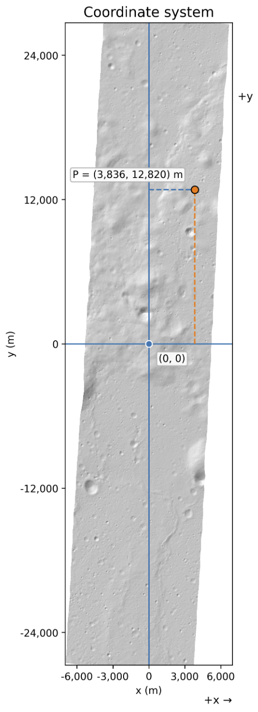
All coordinates need to be inside the basemap area or otherwise the submission will be flagged as invalid. Coordinates can be given as integer or floating point numbers. The origin of the coordinate system for each basemap is always centered, see the following figure:
Conceptually, your submission should look something like that:
{
  "0": [ 23.24, 356.23 ],
  "1": [ -435.23, 599 ],
  ...

  "10409": [ -5512, -13452 ],
}
Our submission format is strict: anything missing, invalid values, or anything that should not be included like duplicates, wrong identifiers, etc. will result in your submission being rejected as invalid. This is to your advantage: each team has only a limited amount of submissions per day, with invalid submissions not counting against that limit.
If your submission passes validation, it enters scoring and will count towards your daily submission limit. A public score will be computed according to scoring and the leaderboard will be updated, giving you glory and world-wide recognition for your lunar geotagging skills!